U.N. Supports New Map Projection to Address Distorted Size of Africa
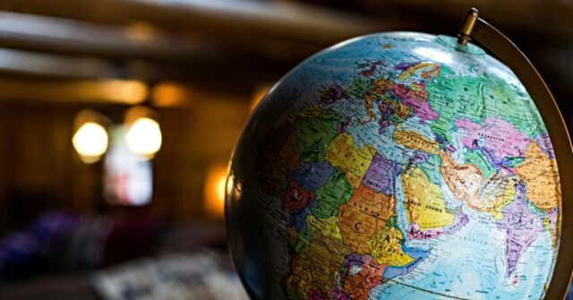
In a landmark decision, the United Nations General Assembly approved a resolution on Friday aimed at altering traditional map projections to better represent the size of Africa. This initiative, the culmination of an African-led campaign, seeks to address the historical inaccuracies perpetuated by the 16th-century Mercator projection. This well-known map format has been criticized for downplaying the true dimensions of the African continent, depicting it as being comparable to Greenland when, in fact, Africa is approximately 14 times larger.
The resolution, which received widespread support amongst member states, has been hailed as a necessary step in countering the longstanding perceptions of Africa as a peripheral area in global discussions. The U.S. stands alone in its opposition, dismissing the “correct the map” initiative as part of a “radical ideological project.” This dissenting vote highlighted ongoing tensions between the U.S. and a growing number of countries advocating for a re-examination of historical narratives.
The new map projections effectively present the United States, France, and Russia as smaller when compared to African nations, a change that has been met with enthusiasm in various sub-Saharan African nations. Supporters of the resolution argue that it helps rectify ongoing disparities, offering a more equitable representation of the continent’s size and potential.
While the U.N. vote was declared non-binding, it signals a significant shift in how geographical representations may evolve within educational and institutional frameworks worldwide. Abstaining from the vote, Estonia, Georgia, Lithuania, Moldova, Serbia, and Ukraine expressed caution, underscoring the complexities of redefining long-standing geographic perceptions.
Critics of the Mercator map have argued that such outdated representations contribute to misalignments in the understanding of geographic and developmental realities. Advocacy groups, including #CorrectTheMap, have further amplified critiques, emphasizing the vast landmass of Africa, which could contain several major countries and regions within its boundaries, highlighting the need for a more accurate portrayal.
The resolution reflects deeper issues regarding how historical contexts shape current global perceptions. U.S. representatives have voiced concerns that the U.N. is diverting attention from pressing international issues by focusing on maps from centuries past, further complicating relations between member states engaged in debates about reparations and equity.
As this reimagining of cartographic representations unfolds, it remains to be seen how these changes will be integrated into educational systems and how they will influence international perceptions of geography and development over time.
#politics #environment